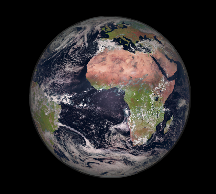
The CaixaForum Girona exhibition Orbital views. Our planet from space takes visitors on a journey through the Earth’s various systems, while also exploring the footprint we leave on them.
Introduction
The exhibition invites us to discover the innate curiosity of human beings to understand the world around us. For centuries, we sought to understand it through our senses, but technological advances have enabled us to go much further. Thanks to satellites, we can now conduct precise, detailed observations of the state of our planet on a global scale, for example by monitoring ecosystems or studying climate patterns.
The exhibition traces the development of observation from the earliest instruments to the latest satellites, such as MetOp-SG-A1, considered the most advanced meteorological satellite in operation today, which was launched into space in August 2025 and is now in polar orbit.
At this point, the exhibition includes, among other exhibits, a full-scale model of the first liquid-fuelled rocket, created by physicist Robert Goddard and launched a hundred years ago, in 1926. Although his prototype bears little resemblance to a modern rocket, it laid the foundations for everything that followed.
Also on display is the first photograph of the Earth taken from space, captured in 1946 from an altitude of 105 km – ten years before the launch of the Sputnik 1 satellite marked the beginning of the Space Age – in which the curvature of the Earth can clearly be seen.
In addition, thanks to a loan from Open Cosmos, visitors will also be able to see a model of Menut, the second nanosatellite launched by the Government of Catalonia. Orbiting approximately 500 km above the Earth, its mission is to observe the planet in order to improve land management and help tackle the effects of the climate crisis.
Another highlight of this section is an interactive print: an interactive projection that responds to touch, revealing hidden layers of information and allowing visitors to identify, for example, the different types of satellites and their applications. Alongside it, an interactive display provides a striking visual explanation of the inner workings of ESA’s Vega-C rocket.
Atmosphere
Observing the atmosphere by satellite makes it possible to monitor atmospheric phenomena and parameters in real time and on a global scale. As they do not depend on ground stations, satellites provide comprehensive and continuous coverage, which is essential for weather forecasting, climate research, the tracking of global warming, predicting extreme weather events, monitoring the ozone layer and assessing air quality.
Observations from space show that human activities affect the atmosphere, but also that shared knowledge and collective action can bring about positive change for our future. One example of this is the ozone layer, the Earth’s protective shield against ultraviolet radiation from the Sun, which is on course to recover over the next two decades thanks to the global ban on harmful chemicals such as those used in aerosols and refrigerants.
This section highlights the work of the Meteosat satellites, which are in geostationary orbit 36,000 km above the Earth and can observe an entire hemisphere of the planet at once, capturing atmospheric data that can be used to produce weather forecasts, track storms, monitor hurricanes and detect fires or fog.
The exhibition also features images that provide an insight into the structure of the atmosphere, including a photograph taken from the International Space Station that helps explain where the atmosphere ends. This boundary, officially known as the Kármán line, lies at an altitude of 100 km and marks the frontier with outer space. At this point, the exhibition explains that only crew members on missions that cross this line are considered astronauts, and that current space tourism involves only suborbital flights, meaning that they do not enter orbit around the Earth.
These concepts are accompanied by an installation paying tribute to astronauts and featuring quotations from them about the overview effect that many astronauts have experienced and described.
This is a feeling of an urgent need to protect the planet, a profound connection with humanity and a shift in perspective that takes hold once you see the Earth from space.
The exhibition includes the words of figures such as Yuri Gagarin – the first person to travel into outer space – and Artemis II crew members such as Christina Koch, who in 2026 took part in the first crewed flight beyond low Earth orbit since 1972.
Also featured in the exhibition is Spanish astronaut candidate Sara García, who is due to travel into space in the near future.
Hydrosphere and cryosphere
Observing the hydrosphere and cryosphere, the Earth’s water and ice, from orbit enables us to monitor the water cycle in real time and on a planetary scale. Satellites track water vapour in the atmosphere, the development of clouds and precipitation patterns, as well as seasonal and long-term changes in ice masses. They also help predict floods and droughts and anticipate phenomena such as El Niño, La Niña and cut-off lows (DANAs), which can lead to extreme weather.
A highlight of this section is a large-format lenticular image – featuring original photographs by Emili Vilamala – that allows visitors to see the landscape of the Sau Reservoir before and after the 2021–2024 drought in Catalonia, which, according to the Meteorological Service of Catalonia (Meteocat), was the most severe since records began.
The loss of ice masses as a result of global warming, which affects sea levels and ocean currents that play an essential role in redistributing heat around the globe, also occupies a prominent place in the exhibition.
A number of interactive multimedia displays provide a graphic illustration of this decline and how it is disrupting the planet’s balance. They present particularly extreme cases, such as the alarming retreat of the Aneto Glacier, on the highest peak in the Pyrenees. This glacier, the largest in Spain, has become thinner and is breaking apart, and its surface area has shrunk to just 30 hectares, as documented by scientists from the Spanish National Research Council (CSIC) in late 2025.
This section also features an illustrative model showing the amount of water on Earth. Although 71% of the Earth’s surface is covered by oceans, making life and the existence of a biosphere possible, only 2.5% of the planet’s water is fresh water. Of this, less than 1% is surface fresh water available for human consumption and ecosystems.
Biosphere
The biosphere comprises all living organisms, from tiny microbes to plants and animals, together with the environments they inhabit. Observing it using satellites and other advanced remote-sensing technologies allows us to assess the overall health of the planet and detect large-scale environmental changes that are invisible from the Earth’s surface.
From space, we can observe, for example, the Amazon rainforest and Australia’s Great Barrier Reef, the largest structure in the world created by living organisms, a large-format image of which can be seen in the exhibition.
As part of its aim to raise awareness of what we stand to lose if we fail to care for the Earth, this section features a wall highlighting the beauty of biodiversity, combining audiovisual content with real specimens from the collection of the CosmoCaixa Science Museum, including butterflies, fungi, beetles, seeds and fossils.
Geosphere
The geosphere is the solid part of the Earth, made up of rocks, soil and tectonic plates, whose configuration is shaped by forces that continuously transform the planet, as demonstrated by earthquakes, volcanoes and ground movement.
Observing the geosphere by satellite allows us to map gravitational and magnetic fields, monitor changes in the state of volcanoes and deserts, track floods and wildfires, and detect changes in coastal topography.
This section is dominated by a satellite image of the 2021 eruption of the Cumbre Vieja volcano on La Palma. Satellites made it possible to track the eruption as it unfolded, helping to manage the emergency, protect public health and understand its environmental impact.
Visitors can learn more about this Earth system through an interactive display case containing rocks and minerals from the CosmoCaixa collection that they can touch. When they do so, information appears about these materials, which are abundant on Earth.
An iron-nickel meteorite represents what can be found in the Earth’s core; a volcanic bomb from Teneguía, which erupted on the island of La Palma in 1971, represents the planet’s upper mantle; basalt is used to symbolise the oceanic crust; and granite, gneiss, quartz and desert rock represent the highly diverse continental crust.
Epilogue
At the end of the exhibition, visitors will find a space for reflection featuring an interactive hemisphere representing the Earth. Various datasets from the German Aerospace Center (DLR) are projected onto its surface, including data on sea temperatures and sea-level rise, temperature anomalies and areas where the world’s population is concentrated.
The exhibition also highlights the positive role that human beings can play on the planet through a section devoted to citizen science projects. These are research initiatives that rely on the participation of members of the public, who help to collect, analyse or disseminate data, thereby assisting researchers in generating knowledge about different ecosystems.
The exhibition presents local examples of successful citizen science projects, such as Mosquito Alert, which allows anyone to submit photographs of mosquitoes and breeding sites to support the study and monitoring of invasive mosquitoes capable of transmitting diseases.
Another example is the Rius Project (River Project), run by the Associació Hàbitats, which provides participants with methodological training, basic tools and support to collect data on the health of rivers.
International projects are also featured, including one at Katla Geopark, Iceland’s first UNESCO Global Geopark, where students and visitors monitor glaciers, map the ice that forms them and record changes over time, as well as tracking changes to the coastline.
- Imágenes
- Videos
- Notas de prensa
Girona07.10.26CaixaForum Girona explores the changing Earth through revealing images taken from space
CaixaForum Girona hosts the premiere of the exhibition Orbital views, which will give visitors the opportunity to admire photographs of the Earth captured by European Space Agency (ESA) satellites during their environmental monitoring missions.
Read more